Skip to content
Menu

We earn a commission if you book through this link. You pay the same price.

Search

Park

Collier-Seminole State Park

Last updated

6,430 acres of mangrove and royal palm hammock twenty minutes east of Marco, with the last Bay City walking dredge parked by the gate.

Photo: Andy Morffew from Itchen Abbas, Hampshire, UKCC BY 2.0

Closed at the moment

Hurricane Ian recovery is ongoing. Individual trails, the blockhouse, paddling hire and some campground facilities have been closed at points through 2026. Check the park's current alerts before you travel.

Drive east out of Marco Island on San Marco Road, meet US-41 and turn left, and within a few minutes the roadside stops being anything and starts being Collier-Seminole State Park. The 6,430 acres here have been protected since 1947, and they are the closest thing to genuine Everglades country you can reach from Marco without a boat.

The park's front gate carries the reason it exists. Parked just inside is a Bay City walking dredge, built in 1924, the last one left of the machines that hacked the Tamiami Trail through the Big Cypress. It did not roll. It walked, jacking itself forward on legs across ground too soft to carry wheels, dragging the highway behind it one bucket at a time. The American Society of Mechanical Engineers designated it a National Historic Mechanical Engineering Landmark, and standing next to it makes the point that nothing about Southwest Florida's road network was inevitable. Marco Island is a resort today because that machine got a road here first.

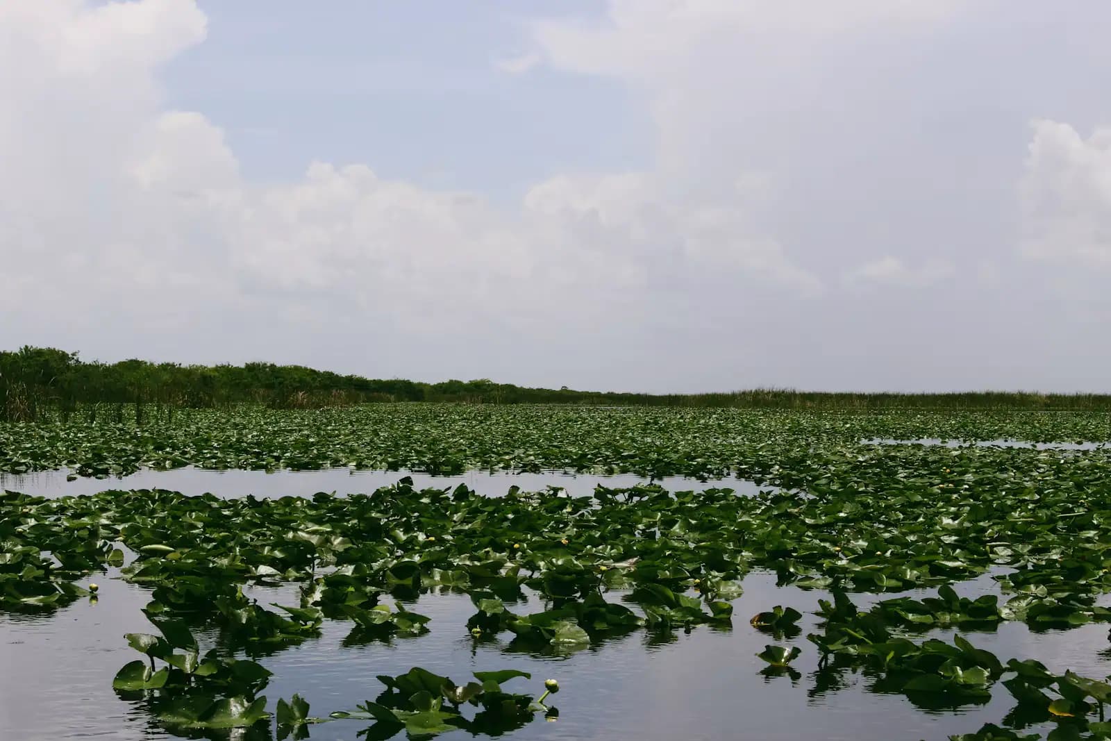
Behind the dredge the park runs from pine flatwoods and salt marsh into cypress and then into mangrove, with a tropical hammock in the middle that holds a wild stand of Florida royal palms — one of very few left growing where they chose to rather than where a landscaper put them. The Blackwater River starts inside the park and works several miles south through the mangroves to Blackwater Bay and out into the Ten Thousand Islands, which is the same water Marco Island sits at the top of.

That river carries a marked paddling trail of about thirteen and a half miles, a boat ramp, and a hiking loop through the flatwoods. There is a campground with RV and tent sites, picnic pavilions and restrooms.

Be realistic about the state of the place. Hurricane Ian went through this coast in 2022 and the park is still working through the damage: trails, the blockhouse and the paddling concession have all been closed or curtailed at points since. Check the park's alerts the morning you go rather than the week before.

Getting there and parking

From Marco Island, take San Marco Road (CR-92) east across the Stan Gober Memorial Bridge and continue to US-41. Turn north-west (left) and the park entrance is signed on the south side of the highway within a few minutes. Allow twenty to twenty-five minutes from the Crescent Beach hotels — this is the closest state park to the island by a wide margin.

From Naples it is about seventeen miles southeast on US-41, thirty minutes outside season.

The entrance road is paved to the ranger station and the campground. There is a boat ramp inside the park giving access to the Blackwater River; trailer parking is limited, so arrive early on a winter weekend.

Everglades City is another forty minutes further east on US-41 and SR-29, which makes the park a natural first stop on a full Everglades day out of Marco.

The machine that built the road to Marco

The Tamiami Trail was one of the hardest pieces of road engineering attempted in the United States in the 1920s: a highway across a limestone swamp with no solid base, no local labour force and no way to bring in fill. The answer was to make the fill on site, blasting and dredging a canal alongside the roadbed and piling the spoil into the road itself.

The Bay City walking dredge at the park gate is the survivor of that fleet. Built in 1924, it moved by lifting itself on hydraulic legs and shuffling forward, because anything on wheels or tracks would have sunk. It is a large, ugly, magnificent object, and it is free to walk around.

Barron Gift Collier bankrolled the trail's completion and took a county named after him in return. The road opened in 1928, and everything that followed on this coast — Everglades City as a company town, Marco Island's development plan four decades later, the resorts on Crescent Beach — runs downstream of it.

Allow fifteen minutes. There are interpretive panels, and if the ranger station is staffed the volunteers there know considerably more than the panels do.

Paddling the Blackwater River

The Blackwater River rises inside the park and runs south through increasingly dense mangrove to Blackwater Bay, which opens into the northern Ten Thousand Islands. The marked trail is about thirteen and a half miles round, and the shorter out-and-back versions are what most visitors actually do.

It is a tunnel paddle rather than an open-water one. Red mangrove arches over the channel, the water goes the colour of strong tea, and sound drops away almost completely. You will see wading birds, mullet spooking ahead of the bow, and, in the cooler months, the occasional manatee working up from the bay.

Plan around the tide. Going down on the ebb and back on the flood is the difference between a pleasant morning and a long one, and the lower reaches shallow quickly. Carry more water than you expect to drink; there is no shade relief once the sun is overhead, despite the canopy.

Hire has been interrupted since Hurricane Ian and has not been reliably available every season. If you need a boat rather than your own, telephone the park before you commit to the drive.

Royal palms, hiking and what may be closed

The park's tropical hammock protects a naturally occurring stand of Florida royal palm, a tree most visitors have only seen in a hotel forecourt. Seeing them growing wild, crowded and uneven among oaks and gumbo limbo, is genuinely different.

The short Royal Palm Hammock nature trail is the usual way in, and there is a longer hiking loop of roughly six and a half miles through pine flatwoods and cypress for anyone who wants distance. There is also a replica blockhouse near the entrance, built in the style of a Seminole War fortification, which has served as the park's interpretive building.

Here is the honest part. Hurricane Ian hit this coast hard in September 2022 and Collier-Seminole has been recovering ever since. Through 2026 the park's own alerts have at various points listed the nature trail closed, the blockhouse closed, paddling hire unavailable, some campground bathhouses shut and the ranger station open on reduced days. None of that is permanent and none of it is predictable from a distance.

Check floridastateparks.org for current alerts on the morning of your visit, or telephone the park. Do not build a day around a specific trail without confirming it is open.

Camping, mosquitoes and the season that actually works

The campground takes RVs and tents and is one of the few places you can sleep within striking distance of both Marco Island and the western Everglades. It books out through the winter, and the state's reservation window opens far enough ahead that February sites go in the autumn.

The season is not a matter of taste here, it is a matter of mosquitoes. From roughly June to October this is mangrove country in the wet season, and the insect pressure after rain is severe enough that the park itself advises screened shelters and repellent. Paddlers get it worst, because you cannot walk away from it.

November to March is the window: cooler, drier, far fewer insects, better birding, and the time when the Blackwater trail is a pleasure rather than an endurance event.

Practical kit for any season — long sleeves, repellent with a real active ingredient, more drinking water than seems reasonable, and closed shoes. There is no shop inside the park worth relying on, and the nearest groceries are back towards Marco.

Tours that visit Collier-Seminole

Operators run these trips past Collier-Seminole, or stop there as part of a longer route. We list what the booking data supports — not everything that mentions the name.

Some links below go to Viator, our booking partner. We earn a commission on bookings made through them — at no extra cost to you, and with no influence on what we recommend.

Shared departurespriced per seat, best value for one or two

Private and small-group optionsoften cheaper per head for a family or a group of six

Near Collier-Seminole

Straight-line distances, so allow more on the road — the island is long and has one main parkway.

  • A straight two-lane road running through low subtropical scrub under a wide sky

    Landmark

    San Marco Road (CR-92)

    Free

    CR-92, the road off Marco Island that no rental-car direction mentions, and the fastest way east to the Everglades.

    0.5–1 hoursFree. No tolls on San Marco Road or on the Stan Gober Memorial Bridge.7.6 mi away

  • Low wooden storefronts with corrugated roofs along a quiet two-lane road in a small coastal settlement

    Neighbourhood

    Goodland

    Free

    A few hundred people, one road in, stone crab traps stacked in the yards. The opposite of the resort side of the same island.

    1.5–5 hoursFree to visit. Boat launch fees apply at the county ramp.5.2 mi away

  • Shallow estuary water running between low mangrove islands at low tide

    Water feature

    Barfield Bay

    Free

    Marco Island's quiet back-side estuary, a foot deep over grass and oyster bar, best seen from a kayak and barely seen from land.

    2–5 hoursFree. Launch and parking fees apply at Caxambas Park, and hire or a guide is charged separately.7.3 mi away

  • A small low-rise town on flat ground beside marsh and open water under a wide sky

    Neighbourhood

    Everglades City

    Free

    Barron Collier's planned company town on the edge of the Everglades, still the land gateway to the Ten Thousand Islands.

    4–8 hoursFree to visit the town. Boat tours, airboat rides and guides are charged separately.15.3 mi away

Collier-Seminole: common questions

How far is Collier-Seminole State Park from Marco Island?

About twenty minutes. Take San Marco Road (CR-92) east off the island, cross the Stan Gober Memorial Bridge, and turn north-west onto US-41; the entrance is signed within a few minutes. That route avoids the Jolley Bridge entirely and is the reason Collier-Seminole is the most practical piece of wilderness for anyone staying on Marco. Everglades City is a further forty minutes east if you want to make a full day of it.

What is the walking dredge at Collier-Seminole State Park?

It is a Bay City dredge built in 1924, the last surviving machine of the type used to build the Tamiami Trail across the Big Cypress and the Everglades. It moved by jacking itself forward on legs rather than rolling, because the ground could not carry wheels, and it dug the canal whose spoil became the roadbed. The American Society of Mechanical Engineers designated it a National Historic Mechanical Engineering Landmark. It sits near the park entrance and costs nothing extra to see.

Can you rent a canoe at Collier-Seminole State Park?

Sometimes, and it is worth checking first. The park has historically run a paddling concession serving the Blackwater River trail, but hire has been interrupted since Hurricane Ian in 2022 and has not been available every season since. If you need a boat rather than bringing your own, telephone the park before making the drive. Paddlers with their own kayak can launch from the park's ramp regardless.

When is the best time to visit Collier-Seminole State Park?

November through March. This is mangrove and cypress country in the wet season, and between June and October the mosquito pressure after rain is genuinely severe — the park advises screened shelters and repellent rather than treating it as a minor nuisance. The dry months also bring better birding, cooler paddling and firmer trails. Check the park's alerts page for hurricane-recovery closures whenever you go.

Is there camping at Collier-Seminole State Park?

Yes. The park has a campground taking both RVs and tents, with restrooms and bathhouses, and it is one of the few places to camp within reach of both Marco Island and the western Everglades. Winter sites book out well in advance through Florida State Parks' reservation system. Some bathhouse facilities have been closed during hurricane repairs, so check what is open when you book.