Skip to content
Menu

We earn a commission if you book through this link. You pay the same price.

Search

Ten Thousand Islands

Kayaking and Paddleboarding on Marco Island

Last updated

Where to launch a kayak on Marco Island, which mangrove tunnels need a rising tide, and how wind decides your paddle. Guided trips and rentals compared.

Dense mangrove shoreline with arching prop roots meeting still green waterUnsplash

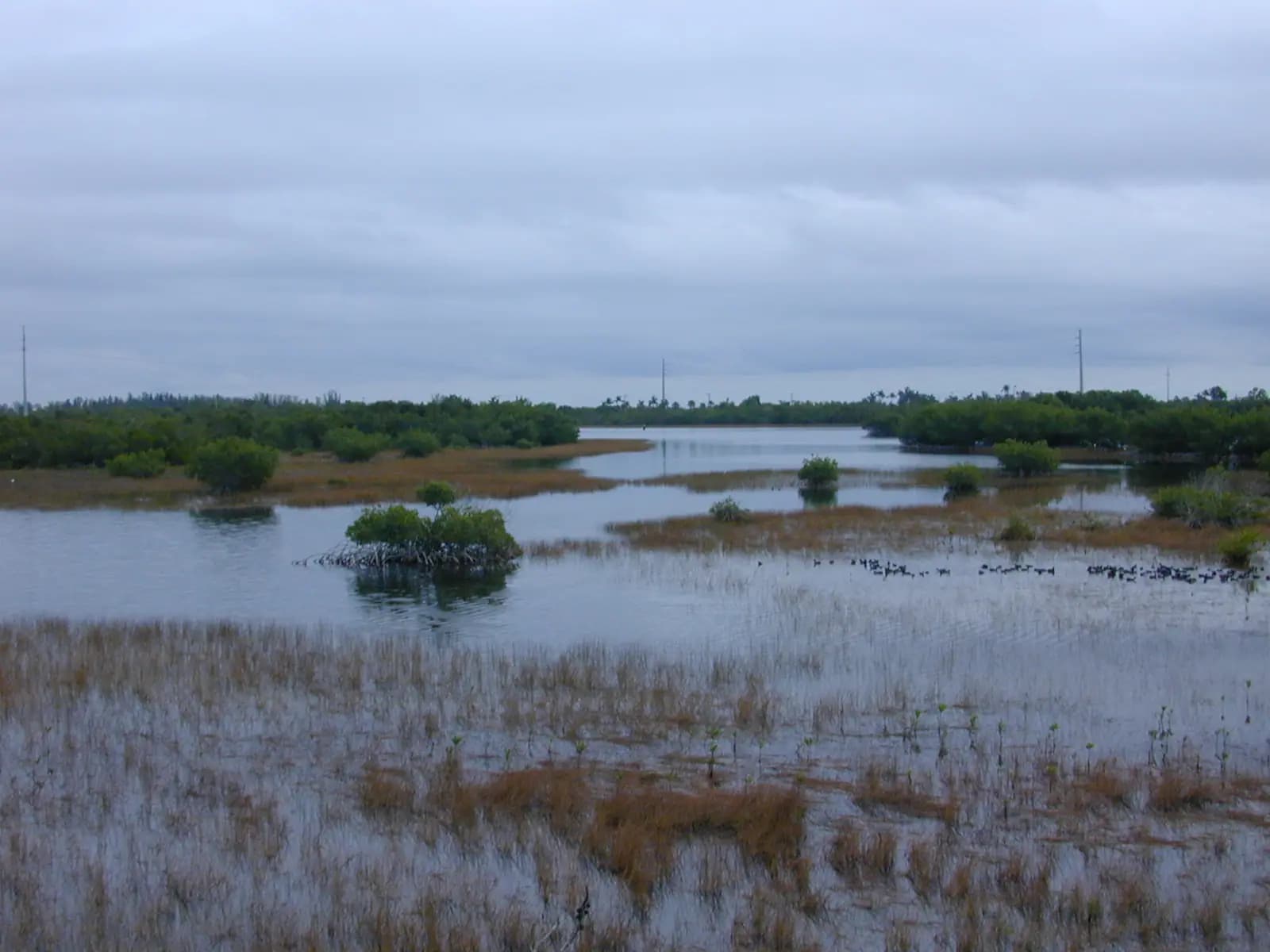
A kayak gets you into the parts of this place a boat cannot reach and a boat's engine would ruin anyway. The mangrove tunnels behind Marco are a few feet wide in places, roofed with prop roots and crowded with mullet, small snook and wading birds that will let a silent hull get remarkably close. Nothing with a propeller goes in there, which is the point.

The island is unusually well set up for it. Marco has protected water on three sides — the Marco River along the north, Collier Bay and Barfield Bay behind, the lagoon system at Tigertail on the Gulf side — plus the Rookery Bay estuary to the north and the Ten Thousand Islands starting immediately to the south and east. Most of it is shallow, most of it is sheltered, and almost all of it is paddleable by someone who has never done this before.

The two variables that decide your day are tide and wind, in that order, and neither is the one beginners expect. Tide first: mangrove tunnels and the shallow back creeks need water in them. On a rising or high tide they open into something like a green corridor. On a falling tide the same route drops you onto oyster bar with a long, cutting walk out, and oyster shell opens skin like a blade. Any guided trip on this island is scheduled around the tide table rather than around a convenient hour, and a rental outfit that does not ask you what time you plan to go is not paying attention.

Wind is the second. There is no surf to worry about here and very little current in open water, but the Gulf sea breeze fills in through late morning and a fifteen-knot afternoon breeze across an open bay turns a pleasant outbound leg into a genuinely hard return. The standard advice on this coast — paddle early, be off the open water by lunch — exists for that reason rather than for the heat.

Third, less romantically: insects. No-see-ums work the backwater at dawn and dusk from spring through autumn, and they are small enough to pass through mesh that stops mosquitoes. A still, warm evening in the mangroves is exactly the conditions they like. Bring repellent, or paddle the middle of the morning.

Everything else is straightforward. The water is warm most of the year, the wildlife is genuinely abundant, and a two-hour guided trip is one of the better value things on an island where most of what happens on the water costs a great deal more.
Our picks

The ones we would book

  • Editor's Pick

    Best guided mangrove paddle

    Why we chose it

    A small-group trip of two to three hours timed to the tide, working the tunnels and creek mouths behind the island rather than a straight run across open bay. A guide who knows which entrances go through is most of the value here, and the group size means you can actually hear what is being pointed out.

    Marco Island and Naples Pedal or Paddle Kayak Tour

    Low Last Minute Supplier Cancellation Rate

    Marco Island and Naples Pedal or Paddle Kayak Tour (opens in a new tab)

    Editor's PickFree cancellationLikely to sell out
    1.2K reviews

    Discover the difference with Marco Ecotours Our tours are more than a business - they are our passion. We strive to ensure that every…

    2 hours

    Prices checked

    from $58
  • Best for Beginners

    Best first time in a kayak

    Why we chose it

    Sheltered water, a stable boat, and a route that does not commit you to a long crossing. The lagoon and bay paddles on this island are calm enough that a complete beginner is comfortable inside ten minutes, and the birdlife means there is something to look at while you get the hang of the paddle.

  • Best for Families

    Best paddle with children

    Why we chose it

    Tandem boats, a short route in protected water and a guide used to eight-year-olds. Ask for a morning slot: flat water, cooler air and fewer insects. Two hours is about the limit of enthusiasm for most children, and the wildlife does the entertaining once you are among the mangroves.

  • Best Value

    Best value paddle

    Why we chose it

    A short guided trip or a half-day rental at the bottom of the local band, which on this island is meaningfully cheaper than almost anything with an engine. You are getting the same mangroves, the same birds and the same water as the boat tours, at walking pace and with a much smaller carbon bill.

  • Small Group

    Best small-group eco paddle

    Why we chose it

    Six or fewer boats with a naturalist rather than a rental attendant. These trips go slowly, stop often and explain what the mangrove is doing, which is the difference between paddling past a green wall and understanding why the fish are in it. Best option for birders and photographers.

Four paddles worth doing

The Tigertail lagoon, one to two hours. The gentlest water on the island. A shallow lagoon sits between the parking area and the Sand Dollar sand spit, and the flats around it hold black skimmers, terns, plovers and whatever is passing through. Beginners and children do fine here. The lagoon was reshaped by a restoration project completed in 2023, and its channels continue to shift, so depths are not what an old guidebook says.

Barfield Bay and the back creeks, two to three hours. Launch from the island's south or east side into shallow bay water with mangrove keys scattered across it. This is where the tunnels are, and where a guide earns the fee — the entrances are not obvious and several go nowhere.

Rookery Bay from Shell Island Road, half a day. Estuary rather than islands: broader water, more birds, and the reserve's research station nearby. Guided trips run from here and are the easiest way to learn what you are looking at.

The Blackwater River at Collier-Seminole, four hours or more. The only marked long-distance trail within easy reach, running from the park's boat basin through mangrove forest and out toward the refuge. Tidal but gentle, well suited to competent beginners, and genuinely remote in its middle section.

Reading the tide before you go

When to go

Marco runs two uneven highs and two uneven lows in roughly 25 hours, with a range often between two and three and a half feet. That sounds trivial. In water a foot deep, it is the whole game.

The working rules most local guides use:

  • Mangrove tunnels want a rising or high tide. Go in on a falling one and you risk being sat on an oyster bar with a long wait or a painful walk.
  • Start on a falling tide and return on a rising one if you are paddling open bay, so the water is helping you home when you are tired.
  • Avoid dead low in the back bays. Large areas simply stop being water.
  • The tide is not the same everywhere at once. The Gulf beach, Caxambas Pass and the upper Big Marco River turn at different times, and inland stations can run close to an hour behind the outside. Use the station nearest where you will actually be.

Combine that with the sea breeze pattern and the shape of a good day becomes obvious: launch early, work the tunnels on the last of the rising water, be back across open bay before the wind stands up. If you are renting rather than going guided, spend five minutes with a tide table before you spend a hundred dollars on boats.

What you see from a kayak that you miss from a boat

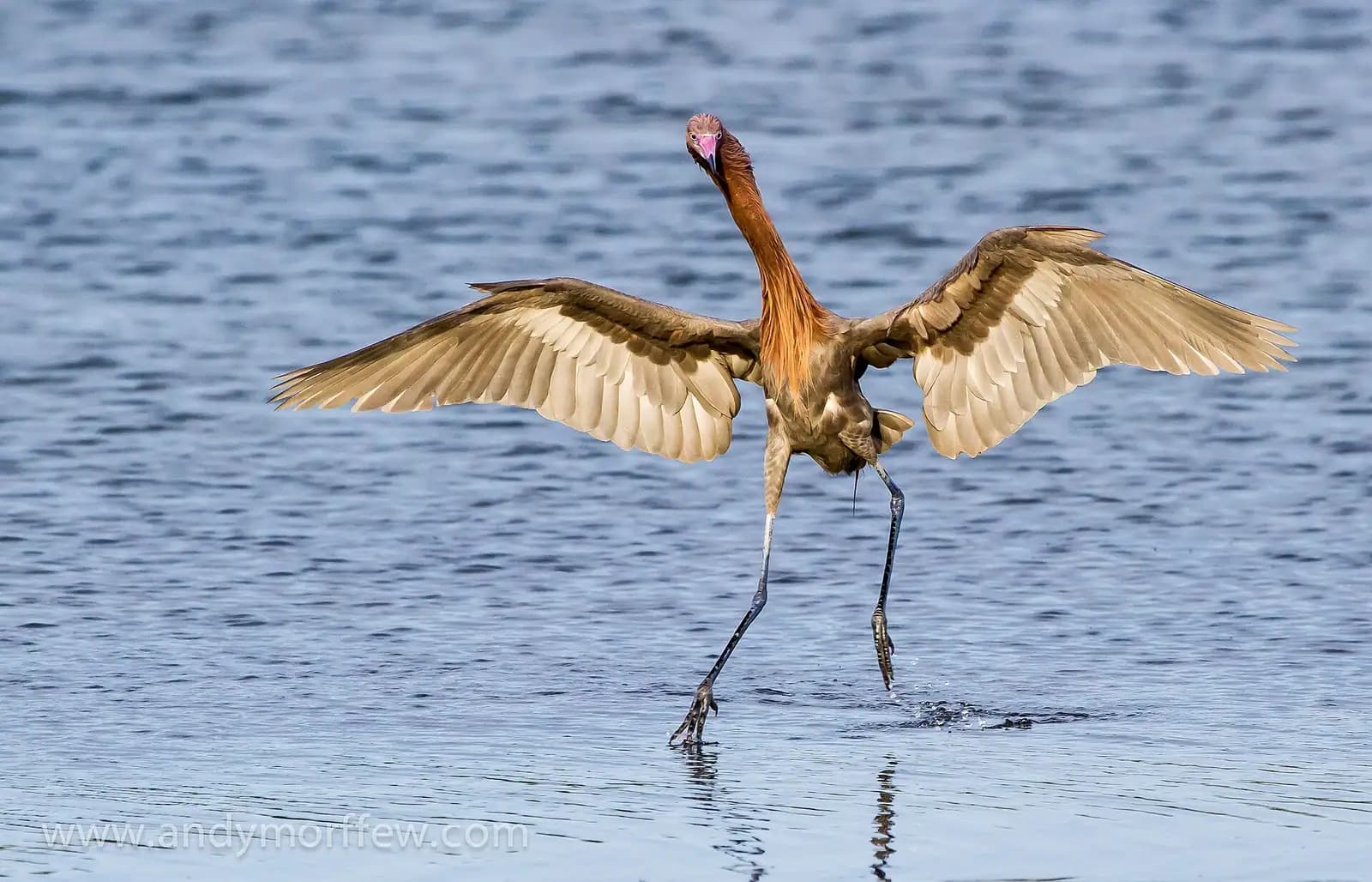
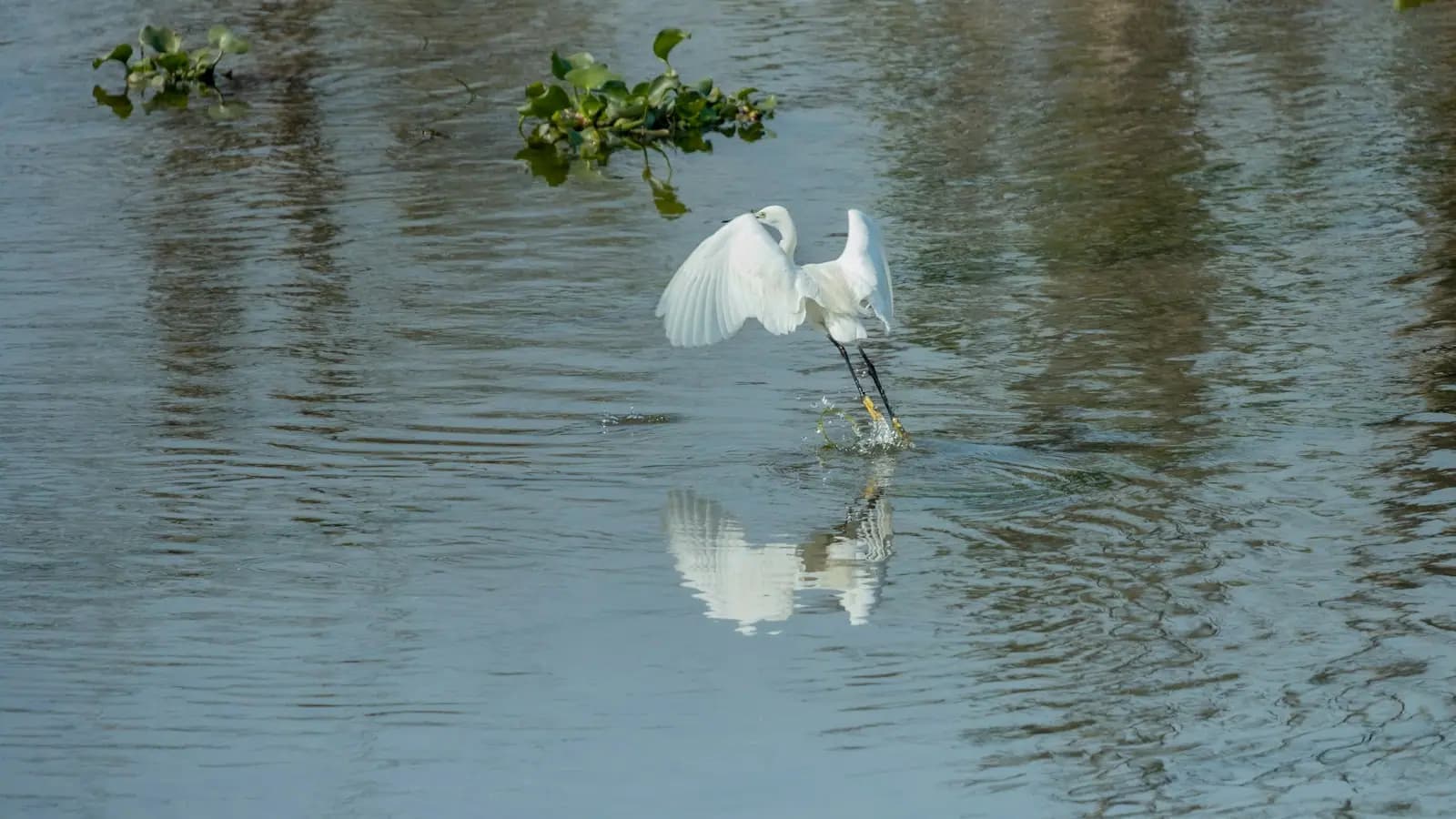
Silence changes everything. Wading birds that lift off a hundred yards ahead of an outboard will often stand and keep fishing while a kayak drifts past — herons, egrets, ibis, and if you are fortunate, a roseate spoonbill sweeping its bill through the shallows.

Ospreys nest on the channel markers and will tell you loudly when you are under one. Mangrove crabs scuttle up the prop roots as you pass. Mullet detonate out of the water for no reason anybody has satisfactorily explained. In the clear water on a rising tide you can watch juvenile snook sitting in the shadow line under the roots, which is the nursery function these forests actually perform.

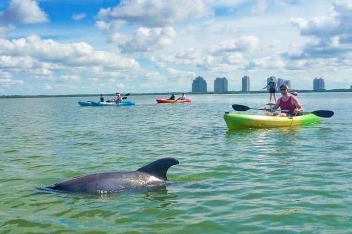
Manatees move into the warmer back bays and canals through winter, and meeting one from a kayak is memorable and completely safe provided you hold your position and let it decide. Dolphins work the river and pass mouths and occasionally the bays behind the island.

Two cautions that are more relevant than alligators, which are rare in this salt water. Nesting shorebird areas on the sand flats are marked and closed in season, including an island in the Rookery Bay reserve that shuts from the start of March to the end of August. And sting rays lie in the sand in the shallows, so shuffle your feet rather than stepping down when you get out.

Guided trip or rental?

A guided two to three hour trip on Marco typically runs in the region of $60 to $100 per person, and for a first paddle it is the better buy. You get a boat sized to you, a route chosen for today's tide, somebody who knows which tunnel entrance actually goes through, and a running commentary on what you are looking at. Groups are usually small.

A rental is cheaper — commonly $40 to $70 for a half day on a single, more for a tandem or a paddleboard — and it is the right call once you have been out here and know the water. Several outfitters deliver, which removes the need to strap anything to a rental car.

What the rental does not include is judgement. The failure mode on this island is not capsizing; it is being three miles into a maze of identical green shoreline on a falling tide with a headwind and no phone signal. That is a bad afternoon rather than an emergency, but it is an avoidable one.

If you are travelling with children, ask about tandem boats rather than singles. A six-year-old in the front of a tandem with a competent adult behind is a good day; a six-year-old in their own kayak in a fifteen-knot breeze is not.

Book it

Everything else we track

Some links below go to Viator, our booking partner. We earn a commission on bookings made through them — at no extra cost to you, and with no influence on what we recommend.

Where to put in

How they compare

LaunchWhereBest forNotes
Tigertail Beach lagoonMarco's north-west Gulf sideAbsolute beginners, birding, paddleboardsSheltered lagoon behind the beach, with the Sand Dollar flats beyond. Paid parking for non-residents; a few dollars for a couple of hours, around ten for the day
Caxambas ParkSouth end of Collier BoulevardReaching Caxambas Pass, Kice Island and the southern shoalsCounty boat park with a ramp; it has been rebuilt since Hurricane Ian damage, so confirm it is open
Isles of CapriOver the north bridgeCapri Pass, the mangrove islands north of the riverSmall, informal, close to the open Gulf — which means more wind
Shell Island Road, Rookery BayOff CR-951 north of MarcoEstuary paddling and guided reserve tripsUnpaved road into the reserve; some islands close seasonally for nesting birds
GoodlandMarco's southeast cornerThe refuge and the back baysWorking village, shortest line into the Ten Thousand Islands
Collier-Seminole State ParkAbout twenty minutes east on US-41A serious day tripMarked paddling trail of thirteen-plus miles down the Blackwater River, with a tide-dependent stretch through Mud Bay

Two more options that get overlooked. Many rental homes and condominiums on Marco sit on a canal, and paddling out of your own dock into Collier Bay at first light is as good a morning as any organised trip. And several island outfitters will deliver a kayak or paddleboard to where you are staying, which solves the roof-rack problem entirely.

What to take

What to bring

  • Water, more than you think. There is no shade out there and no shop.
  • A long-sleeved sun shirt and a brimmed hat with a chin cord. Reflected glare off shallow water burns the underside of your chin and your forearms.
  • Polarised sunglasses on a retainer. You will want to see into the water, and unsecured glasses end up in it.
  • Insect repellent for anything at dawn or dusk. No-see-ums here are a genuine problem for some people.
  • Shoes you can walk in. Oyster bar is unforgiving and mangrove bottom is mud, not sand.
  • A dry bag for phone, keys and a small first-aid kit. Cuts from shell are the most common injury.
  • A whistle and a PFD. Florida requires a wearable flotation device on board for each paddler and, for children under six, worn at all times on a vessel under 26 feet.

Leave word with somebody about where you are going and when you expect to be back. Mobile coverage thins quickly south of Goodland and in the deeper mangrove.

On the ground

Where to go

Every place below has its own page — hours, parking, what it costs and what to expect when you get there.

  • Low sun across a thin sheet of water lying on an exposed sand flat at low tide

    Beach

    Tigertail Beach Park

    Free

    A county park where the Gulf beach sits on the far bank of a tidal lagoon, so the tide table decides what kind of day you get.

    2–6 hoursPark entry is free. Parking is paid at the county kiosk, around $10 per day.

  • Shallow clear water over rippled sand flats with a low sandbar in the distance

    Water feature

    Tigertail Lagoon

    Free

    The tidal flat between the car park and the Gulf: wade it at low water, paddle it at high, and find the best birding on Marco Island.

    1.5–5 hoursFree to enter. Parking at Tigertail Beach Park is charged, at roughly $10 a day.

  • An empty stretch of Gulf beach with a low dune line and no buildings in sight

    Beach

    Kice Island

    Free

    Two miles of empty Gulf beach across Caxambas Pass, boat access only, with no shade, no water and the best shelling near Marco.

    2–5 hoursFree. You pay only to launch or to book a charter.

  • Brackish shallows and low mangrove islands at Rookery Bay, with wading birds on the far bank

    Nature preserve

    Rookery Bay National Estuarine Research Reserve

    The 110,000-acre mangrove estuary between Marco and Naples, with a learning centre as its one easy front door.

    1.5–4 hoursLearning centre around $10 adults, $5 children 4–12, under 3 free. Reserve waters are free to use.

  • A narrow dark-water channel running under an arching canopy of mangrove branches

    Park

    Collier-Seminole State Park

    6,430 acres of mangrove and royal palm hammock twenty minutes east of Marco, with the last Bay City walking dredge parked by the gate.

    1.5–7 hoursA small per-vehicle entry fee in the usual Florida state park band, paid at the ranger station or honour box.

  • Low evening sun across a wide expanse of tall golden marsh grass

    Wildlife

    Ten Thousand Islands National Wildlife Refuge

    Free

    Thirty-five thousand acres of mangrove wilderness with one land trail, one observation tower and eighteen parking spaces.

    1–4 hoursFree. No entry fee and no parking charge at the Marsh Trail.

  • Small charter and fishing boats tied up in a compact working harbour basin

    Marina

    Caxambas Park

    Free

    The county ramp at Marco's southern tip, rebuilt after Ian, and the shortest launch to Kice Island and Cape Romano.

    0.5–4 hoursPark entry is free. Boat launching is charged per launch, with an annual county pass available.

  • Docks and small boats along a narrow residential canal lined with mangroves

    Neighbourhood

    Isles of Capri

    Free

    Four dredged mangrove islands north of the Jolley Bridge, with working marinas, three waterfront restaurants and no beach at all.

    1.5–4 hoursFree to visit. You pay for food, boat hire or a charter, and nothing else.

  • Shallow estuary water running between low mangrove islands at low tide

    Water feature

    Barfield Bay

    Free

    Marco Island's quiet back-side estuary, a foot deep over grass and oyster bar, best seen from a kayak and barely seen from land.

    2–5 hoursFree. Launch and parking fees apply at Caxambas Park, and hire or a guide is charged separately.

  • A raised wooden boardwalk running out across wetland vegetation into open water

    Nature preserve

    Briggs Nature Center and Shell Island Road

    Free

    The half-mile boardwalk has been closed for renovation, but Shell Island Road still holds the best paddling access north of Marco.

    1–4 hoursFree. There is no gate and no entry fee on Shell Island Road.

Straight answers

Questions people actually ask

Where can you launch a kayak on Marco Island?

The main public options are the Tigertail Beach lagoon on the Gulf side, Caxambas Park at the south end, Isles of Capri just over the north bridge, and Goodland on the southeast corner. Shell Island Road gives access to Rookery Bay north of the island, and Collier-Seminole State Park, twenty minutes east on US-41, has the region's marked long-distance trail. Many canal-front rentals let you launch from the dock.

Do you need a guide to kayak on Marco Island?

Not for the sheltered water at Tigertail or a short paddle in the bays. For the mangrove tunnels, yes, at least the first time. The entrances are not obvious from the water, several of them dead-end, and the routes only work on the right half of the tide. A guide also carries the local knowledge about which creeks drain fastest, which is what separates a good paddle from a walk across oyster bar.

How much does kayaking cost on Marco Island?

A guided trip of two to three hours generally runs about $60 to $100 per person, usually in a small group. A rental is cheaper — commonly $40 to $70 for a half day on a single kayak, more for a tandem or a paddleboard — and several outfitters will deliver to where you are staying. Prices firm up through the winter season, so book guided trips ahead from January to April.

Is kayaking on Marco Island safe for beginners?

Yes, in the right water. There is no surf and very little current in the sheltered bays and the Tigertail lagoon, and the water is shallow and warm for most of the year. The hazards are wind, which builds through late morning and makes the return leg hard, and tide, which can leave you aground on oyster bar. Paddle early, check a tide table, and stay off open bay in the afternoon.

What is the best time of day to kayak on Marco Island?

Early morning. The water is flat before the sea breeze fills in, the light is low and good, wildlife is active, and in summer the afternoon storm line has not built. The exception is insects: no-see-ums are worst at dawn and dusk from spring into autumn, so if you react badly to them, mid-morning is the better compromise. Match the launch to the tide either way.

Can you see manatees while kayaking on Marco Island?

In winter, often. As Gulf temperatures drop, manatees move into the canals, the Marco River and the warmer back bays, which is exactly where most sheltered paddling happens. Hold your position and let the animal decide the distance — pursuing, touching or feeding one is prohibited. Dolphins are a year-round possibility nearer the pass mouths, and both are easier to be close to from a silent boat.

Are there alligators where you kayak on Marco Island?

Very rarely in the salt water immediately around the island. Alligators prefer fresh and brackish water, so they are found inland — around Collier-Seminole, the canals along US-41 and the freshwater interior — rather than in the mangrove bays behind Marco. Sting rays in the shallows and oyster shell underfoot are the hazards you will actually meet. Shuffle your feet when you step out of the boat.

Can you kayak from Marco Island to the Ten Thousand Islands?

You can reach the northern edge of the chain from Goodland or Caxambas, but a day paddle from Marco into the outer islands is a bigger undertaking than the map suggests. Crossings are exposed, the wind builds after mid-morning, and the shoreline looks identical in every direction once you are in it. Do it with a guide, or take a boat out and paddle from there.