Skip to content
Menu

We earn a commission if you book through this link. You pay the same price.

Search

Marina

Marco Island Marina

Last updated

122 owner-held slips on the Big Marco River just inside the Jolley Bridge, and one of the few places a visiting boat can stay on Marco.

Marco Island sells itself on boating, and then quietly makes it difficult. There is no municipal transient dock, the passes shift, the bridges are fixed, and most of the good water is behind a private seawall. Marco Island Marina is one of the places that answer the question of where a visiting boat actually goes.

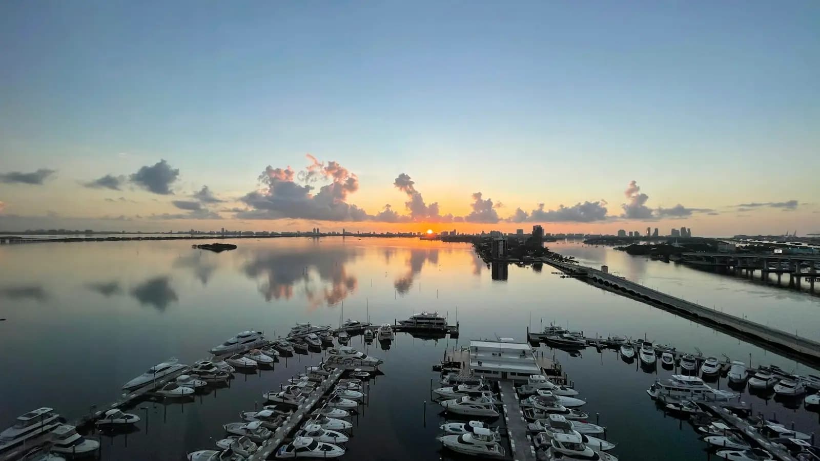
It sits at 1402 North Collier Boulevard on the Big Marco River, a few hundred yards inside the Jolley Bridge, which is the first protected water you reach coming in from Capri Pass. The basin holds 122 slips on floating docks, sized from around 40 feet up to 100, taking beams to about 20 feet and drafts to about seven. Shore power runs to 100 amp, with water and wifi at the slip and a pump-out on site.

The thing to understand before you plan around it is the ownership model. These slips are individually owned, and the owners form the marina's association — this is a dockominium rather than a conventional marina that rents everything it has. Only a small number of berths are available to transients at any time, so a night here is something you arrange in advance, not something you find at four in the afternoon after a long run up from the Keys.

What owners and guests get is closer to a small resort than a boatyard: a heated pool, a gym, laundry, showers, a dog run, grills, bocce, and a lounge. The view from the basin is the Jolley Bridge and, beyond it, the mangrove edge running north into Rookery Bay.

Set against Marco's other options, this is the deep-water, long-stay, well-serviced end of the market. Rose Marina over in Factory Bay is the busier working marina with hire and charters, Calusa Island Marina in Goodland is the closest deep-water access to the Ten Thousand Islands, and the two public ramps handle everyone with a trailer.

Getting there and parking

By road, the marina is on the east side of North Collier Boulevard a short distance south of the Jolley Bridge — the first significant turning once you are on the island.

By water, come in through Capri Pass, run east along the Marco River past Isles of Capri, pass under the Jolley Bridge and the basin opens on the south side. Clearance under the bridge is about 55 feet with no opening, so tall rigs cannot reach it.

There is no fuel dock here. Fuel before you arrive, or use Rose Marina in Factory Bay or San Marco Marina.

For provisioning you need a car. The nearest supermarket is a few minutes south on Collier Boulevard, too far to walk with a trolley load, and taxi availability on Marco thins out in the evening.

Getting in from the Gulf

Two inlets serve Marco Island, and they are not equivalent.

Capri Pass, north of the island, is the deeper and better marked of the two and the one most visiting boats use. It leads into the Marco River, which runs east past Isles of Capri and under the Jolley Bridge.

Big Marco Pass, at the island's northwest corner off Tigertail, is shallower, shoals in a way that a chart from two seasons ago will not reflect, and is best treated as local knowledge only.

Once inside, the Marco River is straightforward, well trafficked and protected in almost any weather. The marina is on the south bank just after the bridge. The constraint is above you rather than below: the Jolley Bridge is a fixed span with roughly 55 feet of clearance and there is no opening, so a tall sailing rig does not come in here at all.

Manatee zones and idle-speed sections apply through parts of the river and are enforced. The wake you throw off past a moored boat is somebody's afternoon.

Slips, services and what is not here

The basin is floating concrete dock, which matters in a place that gets a tide and the occasional serious blow. Electrical service runs 30, 50 and 100 amp, with water and wifi at each slip and a dockmaster on hand for arrivals.

Amenities sit above the usual marina standard because the owners live with them: a heated pool, an exercise room, laundry, showers, barbecue grills, bocce and cornhole, a dog run, and a lounge with a pool table.

What is not advertised here is a fuel dock or a ship's store, so plan fuel at a marina that publishes it — Rose Marina in Factory Bay and San Marco Marina both do. Provisioning means a car or a ride; the nearest groceries are a short drive south on Collier Boulevard, and it is too far to carry a week's shopping.

Transient availability is the real constraint. With most berths individually owned, only a handful are open to visitors, and in season they go early. Contact the marina well ahead rather than assuming.

Where else a boat can go on Marco

The island has more water than it has public access, so it is worth knowing the full set.

  • Rose Marina, in Factory Bay, is the busiest full-service operation on the island: dockage, hire, charters, fuel and a ship's store. It is where most visitors who want a boat for the day end up.
  • San Marco Marina offers wet and dry slips with fuel and a stocked store.
  • Esplanade Marina, on Smokehouse Bay, is the one where you tie up and walk to dinner. Clearance under the channel bridge limits what fits.
  • Calusa Island Marina, in Goodland, is the shortest run to the Ten Thousand Islands and the backcountry, and the one guides favour for that reason.
  • Collier Boulevard Boating Park, the 951 ramp, is the main public launch, just north of the Jolley Bridge.
  • Caxambas Park, at the island's south end, is the public ramp for anyone heading for Kice Island, Cape Romano and the southern islands.

Choose by where you intend to spend your days rather than by the marina itself. The difference between launching at the 951 and launching at Caxambas is forty minutes of running time at each end.

Season, weather and leaving a boat here

The Atlantic hurricane season runs from 1 June to 30 November, and this stretch of coast has taken two serious storms in recent memory — Irma in 2017 and Ian in 2022. Anyone leaving a boat on Southwest Florida's Gulf coast through those months should have a written storm plan, and marinas here expect one.

Outside that, the practical weather pattern is simple. December to April is the settled season: cool mornings, light winds, the occasional cold front that puts a hard north wind on for a day or two. June to September brings heat, humidity and near-daily afternoon thunderstorms that build fast over the Everglades and move west. They are short, they carry serious lightning, and the sensible response is to be off the water by two in the afternoon rather than to outrun them.

Seasonal demand follows the same calendar. Transient space, hire boats, guides and ramp parking are all hardest to get between January and April, and easiest in August when the island is quiet and hot.

Tours that visit Marco Island Marina

Operators run these trips past Marco Island Marina, or stop there as part of a longer route. We list what the booking data supports — not everything that mentions the name.

Some links below go to Viator, our booking partner. We earn a commission on bookings made through them — at no extra cost to you, and with no influence on what we recommend.

Shared departurespriced per seat, best value for one or two

Private and small-group optionsoften cheaper per head for a family or a group of six

Near Marco Island Marina

Straight-line distances, so allow more on the road — the island is long and has one main parkway.

  • Small boats moored along a sheltered river channel with a low mangrove shoreline beyond

    Landmark

    Judge S.S. Jolley Bridge

    Free

    Marco Island's front door: a fixed 55-foot span over the Marco River, with shore fishing at its foot and the busy 951 ramp alongside.

    0.5–3 hoursFree to cross and free to fish from the shoreline. Launching and parking at the boating park are charged.0.6 mi away

  • A wooden pioneer-era house with wide verandahs shaded by mature trees

    Neighbourhood

    Olde Marco

    Free

    The north-end village that was here before the canals were dredged, and the waterfront most Marco boat trips still leave from.

    1–4 hoursFree to walk. Charters, boat rentals and meals are the cost.1.6 mi away

  • Pastel arcaded buildings facing a sheltered marina basin at dusk

    Shopping

    The Esplanade

    Free

    Coastal-Italian arcades along 1,100 feet of Smokehouse Bay, with a 77-slip marina and the island's only dinner-by-boat arrangement.

    1–3 hoursFree to walk through, with free parking. You pay only for what you eat, buy or dock.0.9 mi away

  • Docks and small boats along a narrow residential canal lined with mangroves

    Neighbourhood

    Isles of Capri

    Free

    Four dredged mangrove islands north of the Jolley Bridge, with working marinas, three waterfront restaurants and no beach at all.

    1.5–4 hoursFree to visit. You pay for food, boat hire or a charter, and nothing else.1.7 mi away

Marco Island Marina: common questions

Can visiting boats stay at Marco Island Marina?

A few can, with notice. The slips here are individually owned and the owners form the marina's association, so only a small number of berths are open to transients at any time. Between January and April they are booked well ahead. Contact the marina directly rather than arriving on spec, and have a fallback in mind — Rose Marina in Factory Bay and Calusa Island Marina in Goodland are the usual alternatives.

What size boat fits at Marco Island Marina?

The basin holds 122 slips running from roughly 40 feet to 100 feet, with beams to about 20 feet and drafts to about seven. The binding constraint is usually height rather than length: the Jolley Bridge upstream of the entrance is a fixed span with about 55 feet of clearance and no opening, so a tall sailing rig cannot reach the marina at all, whatever its length.

Is there fuel at Marco Island Marina?

No fuel dock is advertised here. Plan to fuel at a marina that publishes the service — Rose Marina in Factory Bay and San Marco Marina both do, and both are a short run away inside the same protected water. It is worth arriving with a comfortable margin rather than assuming, particularly if you have come across from the Keys or down from Fort Myers.

Which pass should you use to reach Marco Island by boat?

Capri Pass, north of the island, is the deeper and better marked inlet and the one most visiting boats use. Big Marco Pass, off the island's northwest corner near Tigertail, shoals and shifts enough that charts go out of date between seasons, and it is best left to people who run it weekly. Once inside Capri Pass, the Marco River is protected, well trafficked and straightforward in almost any weather.