Skip to content
Menu

We earn a commission if you book through this link. You pay the same price.

Search

Beach

Morgan Beach

Last updated

The furthest of the boat-only shelling beaches south of Marco, on a shoreline that redraws itself after every serious storm.

South of Marco Island the coast stops being a coast and becomes a proposition. Caxambas Pass separates the island from Kice; south of Kice the sand continues in a broken chain towards Cape Romano, and the outer shore along that chain is what charter captains and shellers here call Morgan Beach.

Be clear about what that name is. There is no sign, no park boundary, no ranger station and no agreed line on a map. Morgan Beach is a working name for a stretch of Gulf shoreline around Morgan Pass, used by the people who take boats there, and where exactly it begins and ends depends on who you ask and on what the last hurricane did. That is not sloppiness on anyone's part. It is the nature of the place.

These are migrating barrier islands sitting at the northern end of the Ten Thousand Islands, built and rebuilt by storm and current. Passes open, close and move. Islands join and separate. A chart from ten years ago will show you a shoreline that is no longer where it is drawn, and the locals who run out here navigate by water colour and memory as much as by plotter.

What that instability buys you is the least-walked shell line within reach of Marco. Kice gets day trippers; Morgan Beach gets whoever was prepared to run another fifteen or twenty minutes south. On a good winter day after a hard west wind, that means shell lines nobody has been through.

It also means you should not go alone in a rented kayak. This is open Gulf shoreline with unmarked shoals, real distance from help, no facilities whatsoever and no shade. The sensible way to see Morgan Beach is with a shelling or eco charter that runs it weekly, from Caxambas Park, from a Marco marina or from Goodland.

Getting there and parking

Boat only, and further out than Kice Island. From Caxambas Park at Marco Island's southern tip or from the Goodland ramps, allow twenty-five to forty minutes depending on the boat, the route and the tide.

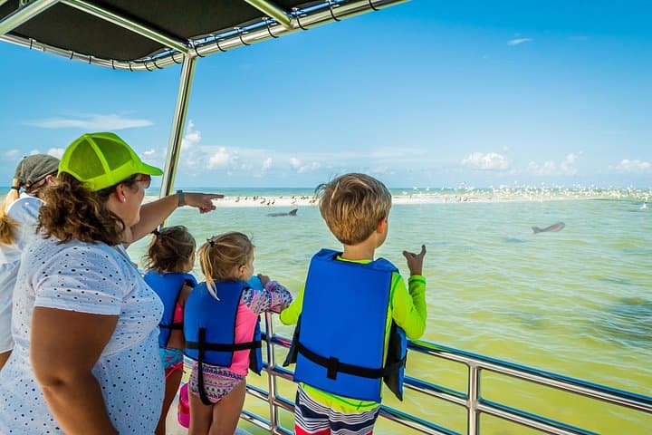
The great majority of visitors arrive on a shelling or eco charter, and that is the right way to do it. Operators running from Caxambas, from Marco's marinas and from Goodland know this stretch and plan the trip around low water.

In your own boat, treat the area as chart-unreliable. Bars are unmarked, they move, and satellite imagery ages quickly. Anchor off and wade in; there is nothing to tie to.

Kayaking here from Marco is not a sensible day out. The distance is significant, there is no bail-out point, and the crossing exposes you to open Gulf conditions that can change within the length of a trip.

A shoreline that will not hold still

Barrier islands are not landforms so much as processes. Sand moves alongshore, storms cut through the narrow places, currents rebuild bars somewhere else, and over a few decades the map changes shape.

On this stretch that process is unusually visible because there is nothing built on it to hold it in place. Between Marco's southern tip and Cape Romano the shoreline has reorganised itself repeatedly in living memory. Islands that were separate have joined; passes that carried a boat have silted; beaches have grown at one end while the other washed away.

Two recent storms did most of the current arrangement. Hurricane Irma came through in September 2017 and Hurricane Ian in September 2022, and both rearranged sand across this whole coast.

The practical consequence for a visitor is simple. Do not plan a route from a satellite image, do not trust a chart, and do not assume that because someone landed on a particular spit last season it is there now. Go with somebody who was out here last week.

Getting there, and why not to do it alone

Morgan Beach is reachable only by boat, and it is further than Kice by a meaningful margin — figure twenty-five to forty minutes from Caxambas Park or Goodland depending on the boat and the tide, against fifteen minutes to Kice by kayak.

That distance changes the risk calculation entirely. You are running open Gulf water or the shoal-strewn back side of the islands, out of easy sight of Marco, with patchy phone coverage and no realistic chance of a walk-out. Unmarked bars sit exactly where a visitor would expect deep water.

Take a charter. Shelling trips, eco tours and private captains run this stretch from Caxambas, from Marco's marinas and from Goodland, and the good ones plan the day around the tide so you get the low-water shell line rather than a wet walk.

If you are going in your own boat: check a tide table for Caxambas Pass, carry paper as well as electronic charts, tell somebody your plan, watch the eastern sky in summer, and anchor properly. There is nothing to tie to and no one to tow you off.

Do not attempt it by kayak from Marco. The distance is survivable and the conditions are not reliable.

What the shell lines hold

The shelling here is the same species mix as the rest of this coast, with the crucial difference that nobody has been through it first.

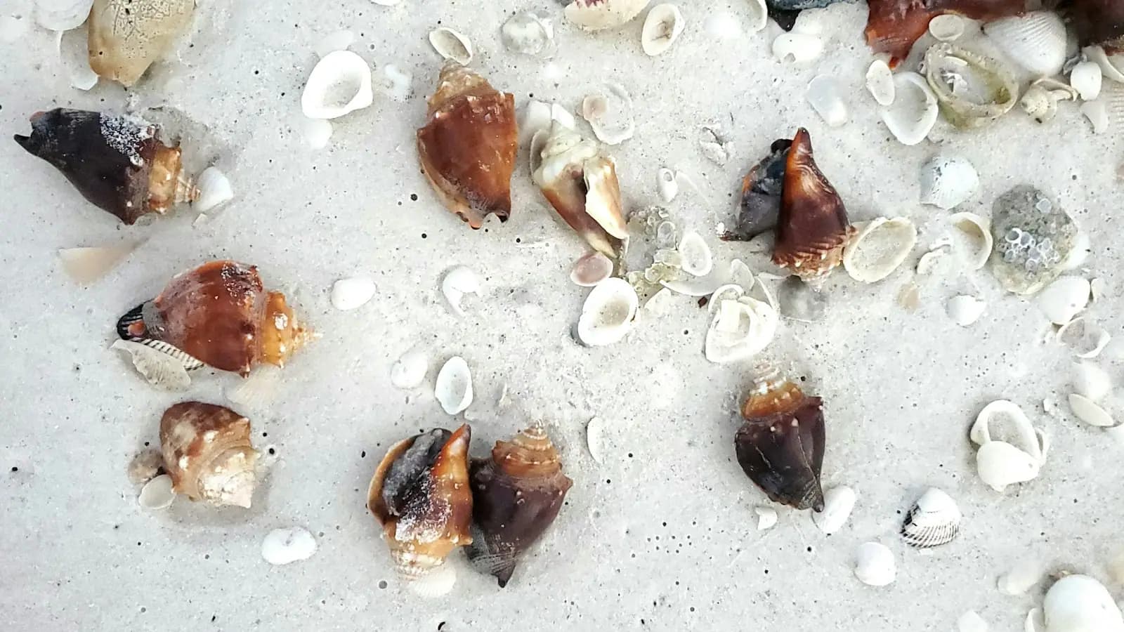
Expect lightning whelks — the left-handed ones, which is worth knowing because they surprise people — Florida fighting conchs, lettered olives, banded tulips, apple murex, cockles, and pen shells standing in the flats. Sand dollars occur on the bars behind the beach, and are almost always alive when you find a good one.

How to work it:

  • Time the trip to low water. A charter that arrives at high tide is wasting your morning.
  • Walk the trough behind the first bar as well as the wrack line.
  • Take a mesh bag, so sand and water drain rather than travelling home with you.
  • Empty shells only. Collier County prohibits collecting live shells. A sand dollar with colour is alive; a fighting conch that moves is alive. Put them back in the water.

The other rule, which matters more here than anywhere: everything you bring, you take away again. There is no bin, no collection and nobody clearing up behind you.

Cape Romano, just beyond

A little further south sit the remains of the Cape Romano dome house, the most photographed ruin in Southwest Florida and a good lesson in what this coast does to buildings.

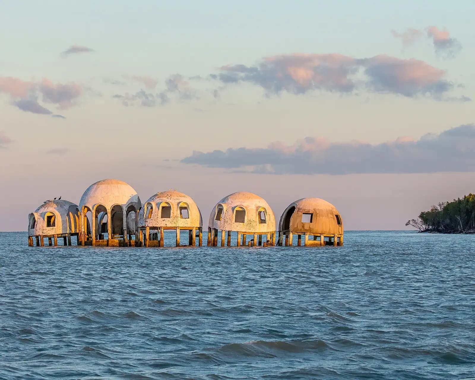
Six domes were built on what was then dry land in the early 1980s. The shoreline retreated year after year until the sea reached them, and by the 2010s they stood in open water like a landed spacecraft. Hurricane Irma took two of them in 2017. Hurricane Ian toppled the rest on 28 September 2022.

Nothing stands above the surface now. What is left is a scatter of pilings and broken concrete in shallow water, visible in calm conditions and invisible in chop, which makes it a navigation hazard as well as a curiosity. Charters still run past; some will stop for a snorkel over the rubble when conditions allow.

Go with adjusted expectations. Photographs taken before 2022 show something that no longer exists, and plenty of tour listings still use them. What you will see is a ruin underwater, not domes on the horizon — which is, in its way, a better story about this coastline than the intact version ever was.

Tours that visit Morgan Beach

Operators run these trips past Morgan Beach, or stop there as part of a longer route. We list what the booking data supports — not everything that mentions the name.

Some links below go to Viator, our booking partner. We earn a commission on bookings made through them — at no extra cost to you, and with no influence on what we recommend.

Shared departurespriced per seat, best value for one or two

Private and small-group optionsoften cheaper per head for a family or a group of six

Near Morgan Beach

Straight-line distances, so allow more on the road — the island is long and has one main parkway.

  • An empty stretch of Gulf beach with a low dune line and no buildings in sight

    Beach

    Kice Island

    Free

    Two miles of empty Gulf beach across Caxambas Pass, boat access only, with no shade, no water and the best shelling near Marco.

    2–5 hoursFree. You pay only to launch or to book a charter.1.4 mi away

  • Heavy cloud building over open water in the late afternoon

    Landmark

    Cape Romano Dome House

    Free

    The domes off Cape Romano fell in Hurricane Ian. What is left is pilings and rubble in open water, and still worth the run south.

    0.5–1 hoursFree to look at from the water. The cost is the boat or the charter seat.2.3 mi away

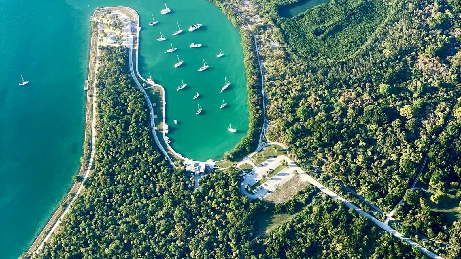
  • Small charter and fishing boats tied up in a compact working harbour basin

    Marina

    Caxambas Park

    Free

    The county ramp at Marco's southern tip, rebuilt after Ian, and the shortest launch to Kice Island and Cape Romano.

    0.5–4 hoursPark entry is free. Boat launching is charged per launch, with an annual county pass available.2.5 mi away

  • Low wooden storefronts with corrugated roofs along a quiet two-lane road in a small coastal settlement

    Neighbourhood

    Goodland

    Free

    A few hundred people, one road in, stone crab traps stacked in the yards. The opposite of the resort side of the same island.

    1.5–5 hoursFree to visit. Boat launch fees apply at the county ramp.5.1 mi away

Morgan Beach: common questions

Where is Morgan Beach near Marco Island?

It is the Gulf shoreline between Kice Island and Cape Romano, south of Marco Island around Morgan Pass. There is no sign, no park boundary and no agreed line on a map — Morgan Beach is the working name used by the charter captains and shellers who go there. The exact shape of the place changes with storms, which is why local knowledge matters more here than a chart or a satellite image.

Is Morgan Beach better for shelling than Kice Island?

Usually, for one reason: fewer people reach it. Kice is fifteen minutes from Caxambas Park and gets day trippers; Morgan Beach is another twenty minutes or so further and gets only those on a boat prepared to run it. The species are the same — lightning whelks, fighting conchs, lettered olives, banded tulips, pen shells — but the lines are less picked over. Go at low tide after a winter cold front for the best of it.

Can you still see the Cape Romano dome house?

Not above water. Six domes were built in the early 1980s on land that the sea later took. Hurricane Irma destroyed two in 2017 and Hurricane Ian toppled the rest on 28 September 2022. What remains is pilings and broken concrete in shallow water, visible in calm conditions and a navigation hazard in chop. Many tour listings still use photographs taken before 2022, so adjust your expectations before booking.

Can you kayak to Morgan Beach from Marco Island?

It is not a sensible day out. Morgan Beach is considerably further than Kice Island, the route crosses open Gulf water and unmarked shoals, there is no bail-out point, and phone coverage is unreliable. Conditions can change within the length of the trip. Take a shelling or eco charter from Caxambas Park, a Marco marina or Goodland instead — they run it weekly and plan the day around the low tide.